
Flexible scale and geography
Create operational wargame maps
Start with a general-purpose operational template for an original theater, campaign, or regional map. Define the scale, geography, terrain, and transport networks required by your design.
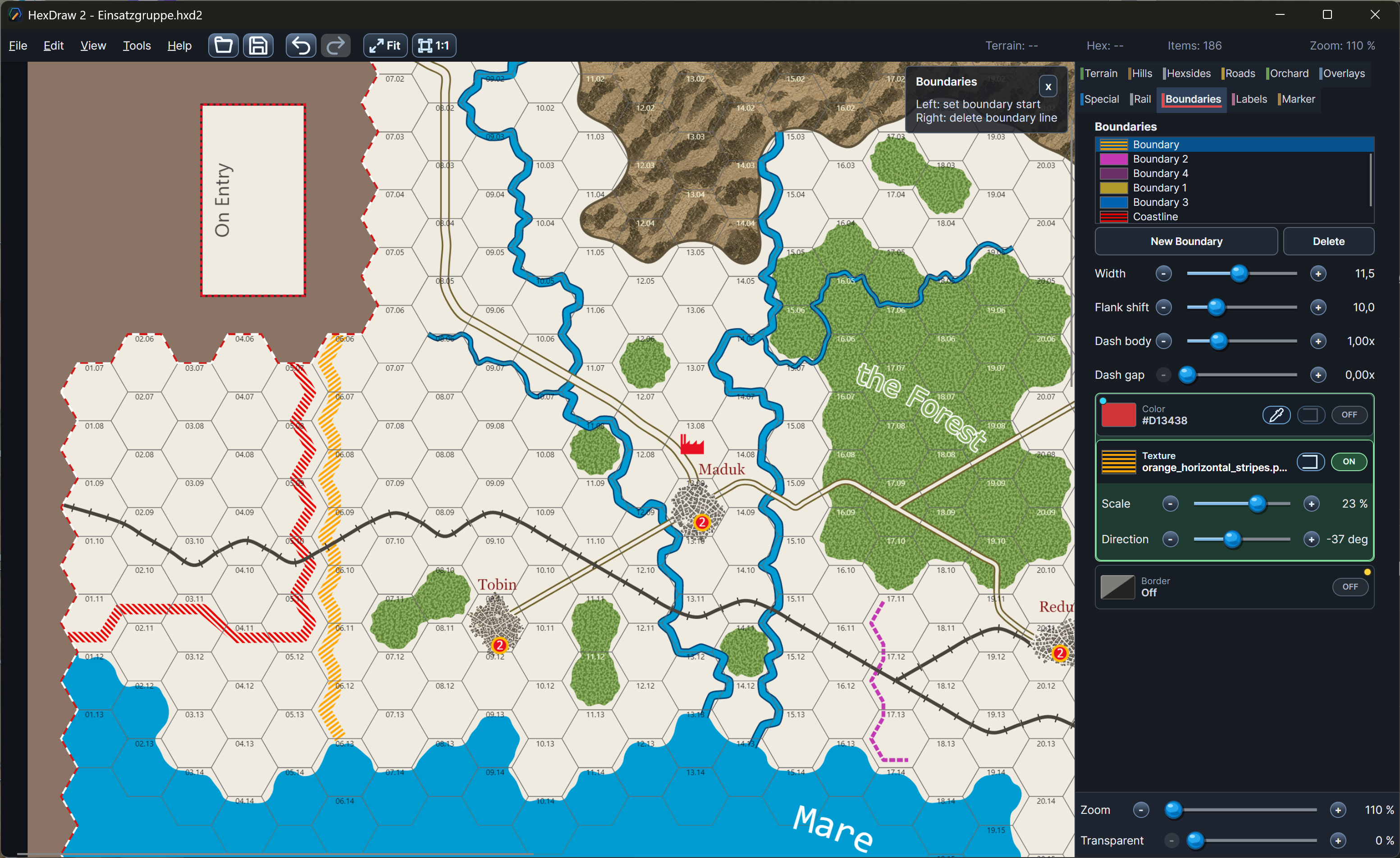
A flexible foundation
What the blank template preconfigures
The operational preset provides a clean large-format hex map and a practical starting set of terrain, route, settlement, label, and boundary tools. Hex size and scale remain deliberately flexible so the same foundation can support an operational area or a broader campaign map.
- Large-format blank hex grid
- Flexible hex size and scale
- Operational terrain and route tools
- Labels, markers, and boundaries
Map characteristics
Broad regions connected by meaningful networks
Operational maps communicate large terrain regions rather than tactical detail. Coastlines or rivers can shape movement where applicable; roads and railways connect towns and cities; broad elevation areas, boundaries, and flexible labels give structure to the theater.
Relevant tools
Organize geography, movement, and information
Paint connected terrain and broad hill regions, draw long roads, rail lines, rivers, coastlines, and boundaries, then place towns, cities, markers, and curved or rotated labels. Offboard areas can hold entry information beyond the playable grid.
- Large terrain and elevation regions
- Road and rail networks
- Rivers, coastlines, and boundaries
- Cities, markers, and flexible labels
Operational details
Blank format, networks, and regional terrain
Define your own scale
All starting settings can be changed
Adjust map dimensions, orientation, hex size, scale, numbering, terrain palette, features, labels, and output for the needs of an original operational or campaign design.
Return to all HexDraw map templates