
Historical battlefield cartography
Create original maps for GMT Games’ GBACW Series
Use HexDraw 2 to turn historical reference material into an original battlefield map for the Great Battles of the American Civil War (GBACW) format, without reproducing a published game map.
Historical board setup
What the blank template preconfigures
The GBACW preset supplies suitable map dimensions, hex layout, numbering, terrain definitions, and elevation tools. The board begins empty, ready for terrain traced and interpreted from source material you have the right to use.
- Suitable battlefield dimensions
- Numbered historical hex layout
- Terrain and elevation setup
- Large-map print preparation
Map characteristics
Ridges, watercourses, routes, and landmarks
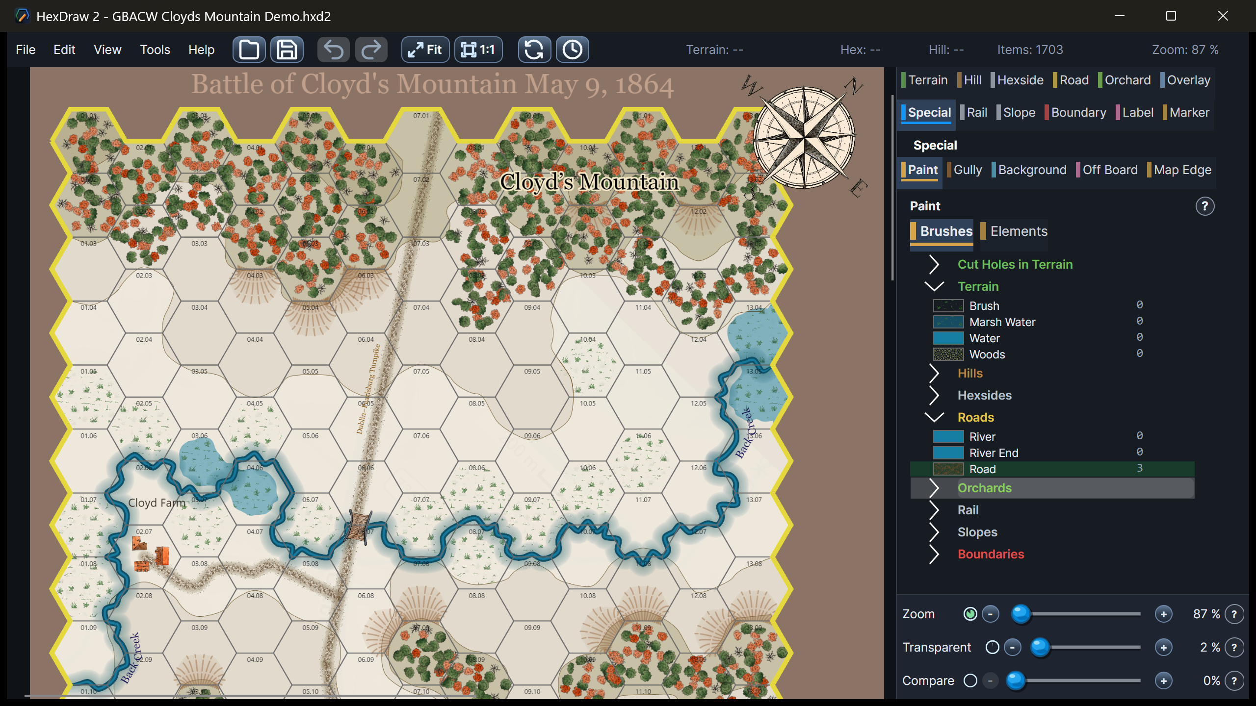
Historical battlefields depend on the relationship between elevation and movement. Broad hills and detailed slopes frame wooded areas, roads, creeks and rivers, farms, buildings, and named locations. Labels help connect the playable map to its historical geography without obscuring the hex grid.
Relevant tools
Translate historical sources into editable terrain
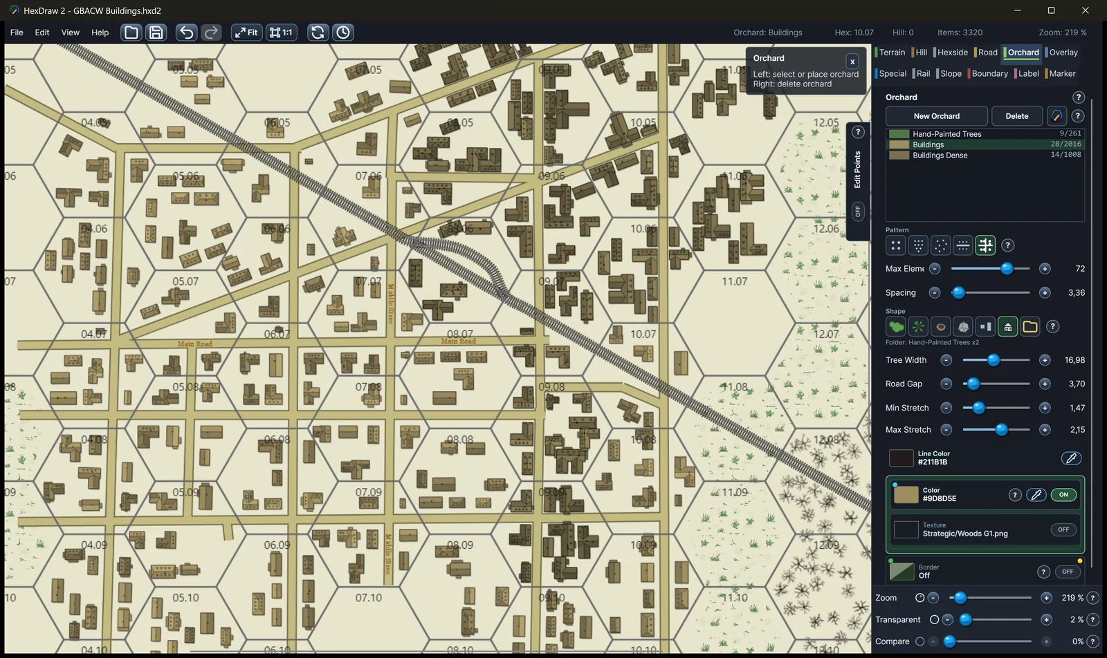
Place a permitted reference image beneath the map, then position, scale, rotate, and fade it while rebuilding terrain above. Vector Paint creates long roads and watercourses with few control points; hill, terrain, orchard, building, and label tools add the battlefield detail.
- Reference-image underlays
- Elevation levels and slopes
- Roads, creeks, and rivers
- Woods, farms, buildings, and labels
Battlefield details
From blank grid to printable historical map
Adapt the format
Every setting remains available
Change the grid, dimensions, numbering, elevation palette, terrain, artwork, labels, or print setup whenever the scale and geography of an original battlefield require it.
Return to all HexDraw map templatesHexDraw 2 is an independent product and is not affiliated with, sponsored by, endorsed by, or approved by the publishers or rights holders of the games and series referenced on this page. Product and series names are used solely to describe compatible map formats and possible applications.